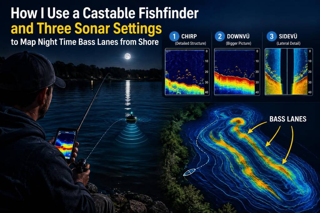
I started using a castable fishfinder a few seasons ago to solve a simple problem: how to find the lanes bass use at night without spending hours blind-casting rocky margins. Night fishing from shore is a different animal — fish are less predictable, tides and light matter more, and you can’t always see the subtle features that hold fish. A castable sonar changed that for me. Below I walk through how I use one, the three sonar settings I switch between, and the practical steps I take to map reliable bass lanes along Welsh coasts.
Why a castable fishfinder is worth taking to the beach
Onshore night fishing, I want information fast. A castable fishfinder (I mainly use a Deeper PRO+ and have tried a Garmin Striker Cast) gives me a real-time picture of what's under the water beyond the visible break. It’s compact, simple to deploy, and — crucially — lets me mark waypoints so I can come back later with confidence. For bass at night, I’m not looking just for individual fish; I’m looking for corridors where they repeatedly move between feeding and shelter — the lanes.
Gear and setup I use
My standard kit for this kind of survey night includes:
I pair the fishfinder over Wi‑Fi rather than Bluetooth when possible — the connection is more stable at distance. Before I head out, I check the device battery and update the app so I don’t lose mapping features mid-session.
The three sonar settings I use and why
Over the years I’ve settled on three go-to sonar modes that together form a simple but powerful survey routine. I switch between them depending on what I need to see: bottom structure, baitfish activity, or individual targets (bass) moving through a lane.
| Setting | Purpose | How I use it |
|---|---|---|
| Low Frequency / Wide Beam | Map broad contours and locate major features (ridges, gutters, sandbanks). | I start here on an outgoing or incoming tide to get the lay of the seabed beyond visible surf. |
| High Frequency / Narrow Beam | Resolve details — deeper gullies, concrete blocks, drop-offs, kelp edges where bass ambush. | Once I know where the main shape is, I use this to zero in on potential lanes and features bass might use. |
| Fish Mode / Sensitivity Boost | Detect bait schools and moving targets; watch for movement that suggests passing bass. | I run this in short bursts to pick up mid-water activity and to confirm lanes are active. |
Step-by-step: How I map a night-time bass lane
I usually arrive before dusk and work through a checklist in the following order.
Interpreting sonar returns at night
Interpreting sonar is partly technical and partly pattern recognition. A few things I look for:
At night, I pay attention to motion more than static targets. Bass often cruise along edges, and a single pass can miss them. Seeing repeated movement in the same spot at similar tide states is the best confirmation.
Mapping and saving spots for future nights
I use the mapping features to build a small library of lanes. For each waypoint I save:
Over time these notes let me predict when a lane is likely to be active. On a busy weekend I can return to a lane I mapped months ago and expect a similar pattern if tides and moon phase match closely.
Practical tips and common pitfalls
Mapping bass lanes with a castable fishfinder has made my night sessions more efficient and more successful. It’s not a magic bullet — bass still read the tide better than any gadget — but it gives me a reproducible way to find the corridors they use. When I combine those mapped lanes with the right lures, timing and a little patience, the night fishing takes on a new rhythm: fewer blind casts, more confident, targeted presentations under the stars.